Project information
- Category: Web design
- Client: IT Career Switch
- Project date: 13 October, 2023
- Project URL: https://awakhiwekhabo.co.uk/gazetteer/
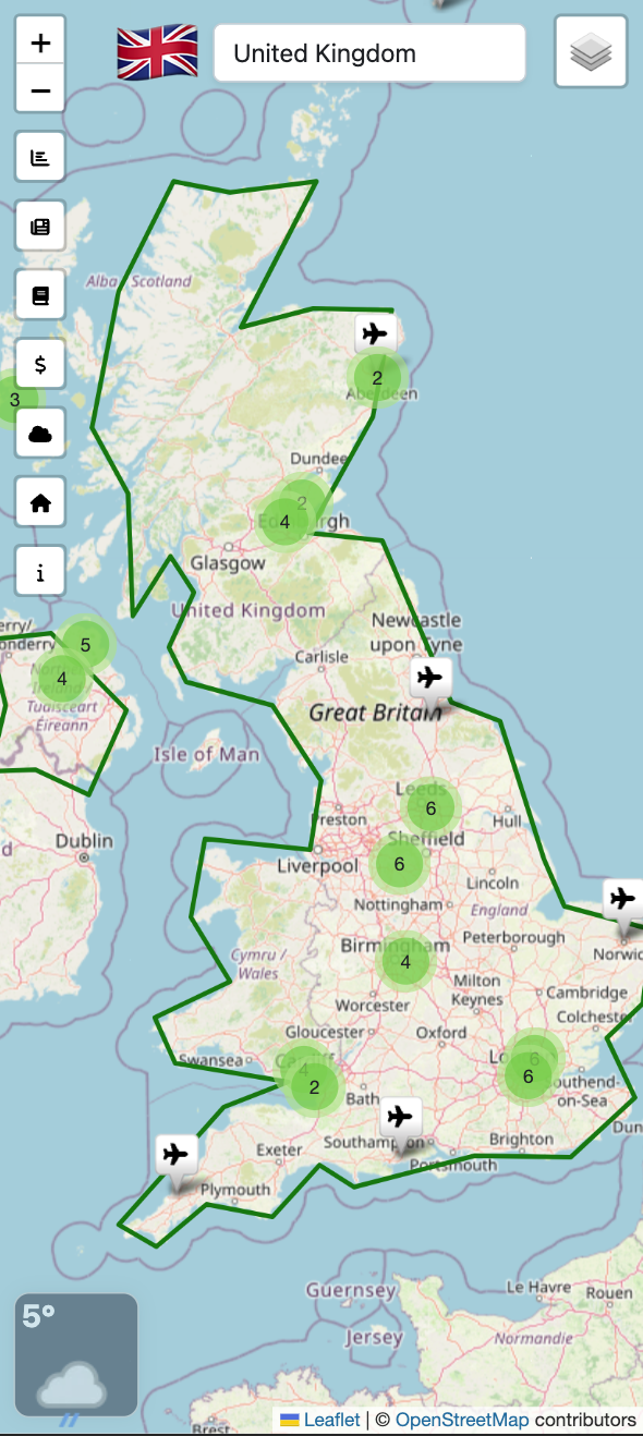
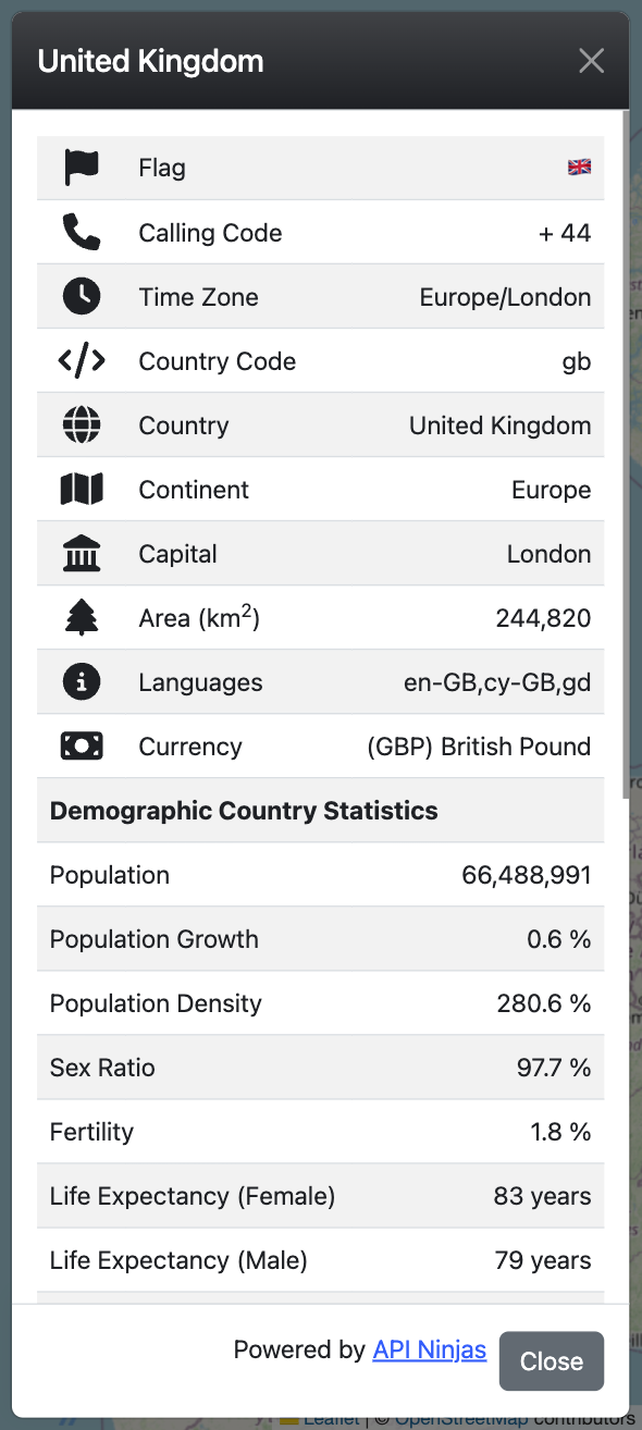
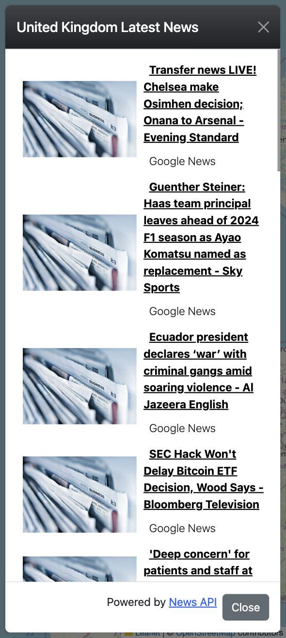
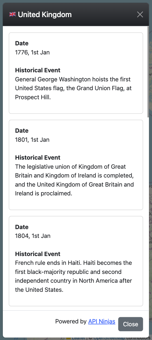
Gazetteer
A web-based application designed to offer users an interactive exploration of geographical, demographic, climatic, cultural information, and other data about countries. The project employs a variety of technologies to create a seamless and engaging user experience.
Technologies Used:
- Bootstrap: Utilized for responsive and visually appealing design, ensuring compatibility across various devices.
- Leaflet JS Library: Integrated for interactive maps and geographical data visualization.
- JavaScript and jQuery: Implemented to enhance interactivity and dynamic content manipulation on the client side.
- PHP: Employed for server-side scripting, enabling the application to interact with APIs and handle server-related functionalities.
- Ajax: Implemented for asynchronous data exchange between the client and server.
APIs:
The project relies on several external APIs to fetch real-time and dynamic data, enriching the content and functionality.
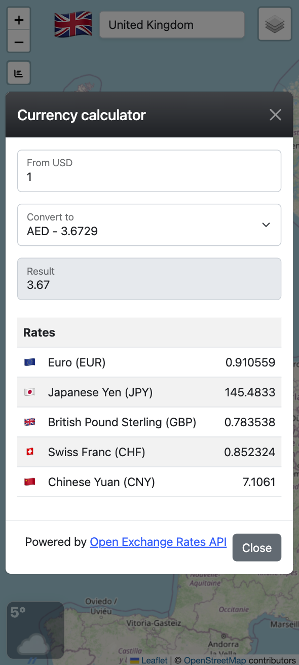
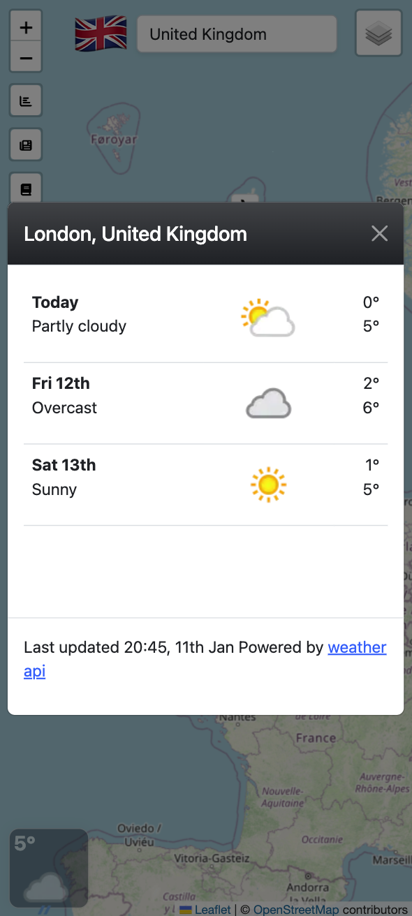
- OpenWeather API: Used to retrieve up-to-date weather information for different countries.
- Open Cage API: Integrated for geocoding services, converting location descriptions into geographical coordinates.
- Open Exchange Rate API: Utilized for currency exchange rate information, enhancing the application's financial data features.
- GeoNames API: Integrated to access geographical data and enrich the application's content.
- API Ninja: Employed for accessing various APIs that provide additional valuable information.